| |
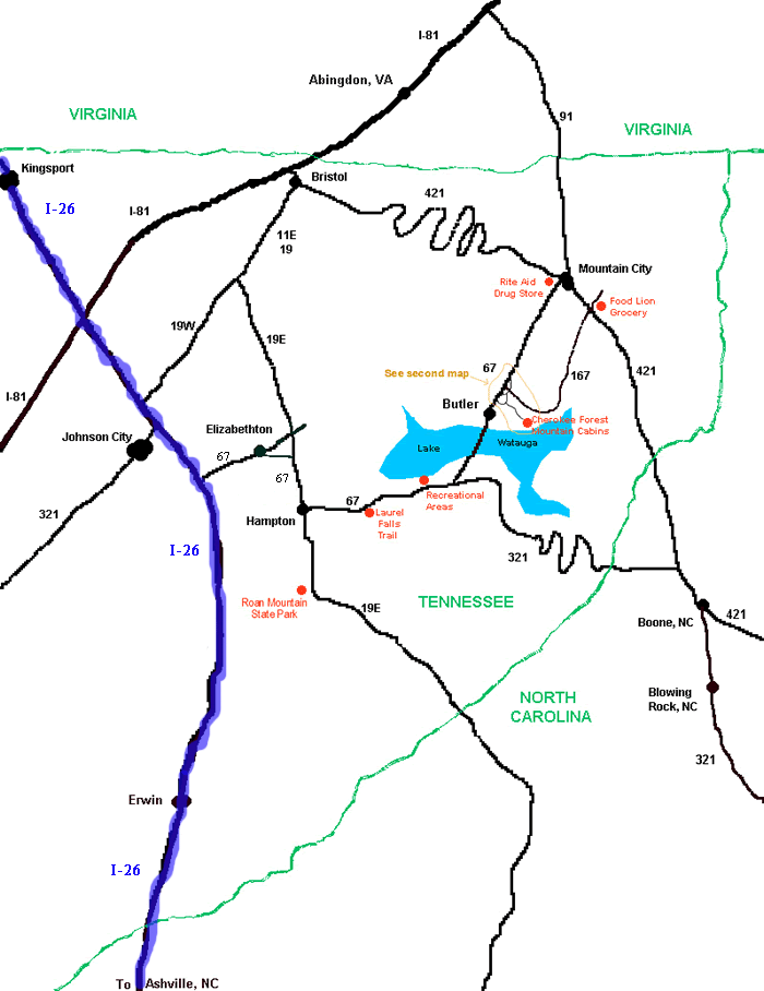
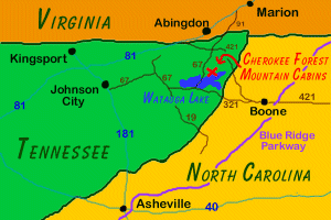 We are located in Butler, TN, in the upper northeast corner of Tennessee, near the Virginia and North Carolina borders. The closest airport is the Tri-City Airport in Johnson City, TN (TRI). Our cabins about a 50-60 minute drive from the Tri-City Airport.
 Approximate Driving Distances:
| From |
Mileage |
Drive Time |
| Asheville, NC |
100 miles |
2.25 hours |
| Atlanta, GA |
300 miles |
7 hours |
| Birmingham, AL |
400 miles |
8 hours |
| Boston, MA |
825 miles |
17 hours |
| Charleston, SC |
350 miles |
7.75 hours |
| Chicago, IL |
650 miles |
14.5 hours |
| Cincinnati, OH |
375 miles |
8.5 hours |
| Dallas, TX |
975 miles |
19 hours |
| Louisville, KY |
350 miles |
8.25 hours |
| Nashville, TN |
325 miles |
7 hours |
| New Orleans, LA |
750 miles |
13.75 hours |
| Orlando, FL |
650 miles |
14 hours |
| Philadelphia, PA |
525 miles |
11.25 hours |
| Raleigh, NC |
225 miles |
5 hours |
| St. Louis, MO |
625 miles |
12.5 hours |
| Washington, DC |
400 miles |
8.5 hours |
For more information:
Google Maps - Calculate your driving distance and time and using this interactive map of our location.
Driving Directions
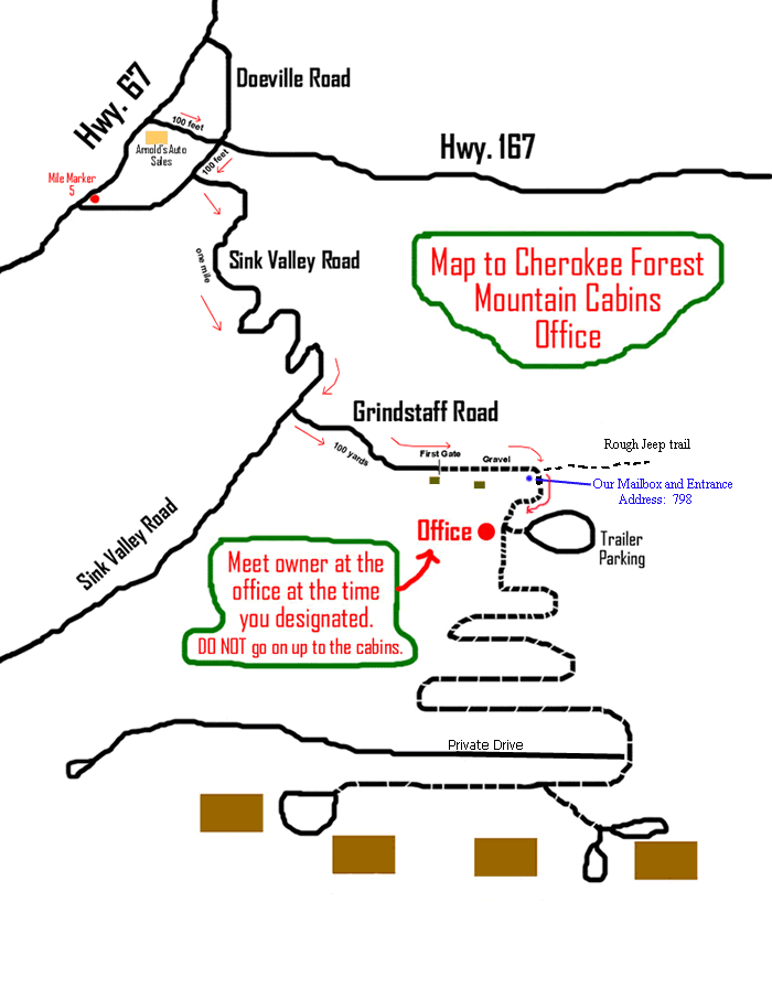
Detailed driving directions are available for the routes listed below. The directions are in .pdf format (requires Adobe Reader). Each set of directions includes the two regional maps shown to the right, which are suitable for printing (8"x10").
|

 •
•
 •
•
 •
•
 •
•
 •
•
 •
•
 •
•